Franz-Josef Behr | Presentations
Open Source
- Behr, F.-J. (2025): From Technocracy to Data Sovereignty, Open Data and Geospatial Technologies, 11.09.2025, AGSE 2025, Bogotá, Colombia [pdf]
- Behr, F.-J. (2024): Architectures of Web Applications: Languages and Tools - Quelloffene Softwarekomponenten im Bereich der raumbezogenen Datenverarbeitung
- Behr, F.-J. (2021): The Commons as an inner Habit and the Impact of the OSGeo Foundation , 02.10.2021, FOSS4G Asia 2021
- Franz-Josef Behr, Tanzeel Khan (2021): Development of an Open Source Geospatial Certification Model: A Key To Empowerment Of Geospatial Education , Geo4All Annual General Meeting (AGM), Como, Italy
- Franz-Josef Behr, Tanzeel Khan (2015): Development of an Open Source Geospatial Certification Model: A Key To Empowerment Of Geospatial Education , GISCO, 19 November 2015, University of Bamberg, Germany
- Franz-Josef Behr, Tanzeel Khan, Phillip Davis (2015): Development of an Open Source Geospatial Certification Model: A Key To Empowerment Of Geospatial Education , ICC 2015, Rio de Janeiro, Brazil
- Franz-Josef Behr, Tanzeel Khan, Phillip Davis (2015): A FRAMEWORK FOR AN OPEN SOURCE GEOSPATIAL CERTIFICATION MODEL , ISPRS 2016, Prague, Czech Republic, Best Poster Award
- Behr, F.-J. (2019): Open source components for Service-Oriented Mapping applications , 15.07.2019, Tokyo, Japan
- Behr, F.-J. (2018): The Commons as an inner Habit and the Impact of the OSGeo Foundation , 17.10.2018, Department of Geography, University of Pretoria
- Behr, F.-J. (2013): Open Source, OSGeo,and its contribution to eLearning , 21 Dezember 2013, AGSE 2013,CEPT University, ISPRS WG VI/2 Workshop: Innovative Learning Tools
- Behr, F.-J. (2012): Open Source - OSGeo - Spatially Empowered Open Source, 11 April 2012, University of Kerala, India
- Behr, F.-J. (2012): PostGIS , Workshop, 12 April 2012, IIITM-K, Trivandrum
OGC WebServices and Standards
- Behr, F.-J. (2023): OGC Standards for making geospatial data, maps and charts findable, accessible, interoperable, and reusable: Technical foundations of OGC standards , 13.08.2023, ICC 2023, Cape Town, South Africa, DOI: 10.13140/RG.2.2.34381.35045
- Behr, F.-J. (2023): OGC's API - from WMS/WFS to Open API , ICC 2023, ICA Commission on SDI and Standards
- Behr, F.-J. (2023): OGC: An overview
- Behr, F.-J. (2021): Technical perspective on map styling languages , Workshop, ICA Commission on SDI & Standards Monday, 13 December, 2021
- Behr, F.-J. (2018): Interoperability, OGC Web Services and Standards, 24.10.2018, Chief Directorate: National Geospatial Information in Cape Town, South Africa
- Behr, F.-J. (2013): Open Source and the Approach of OSGeo , 19 Dezember 2013, AGSE 2013,CEPT University
- Behr, F.-J. (2005): XML-basierte Visualisierung von Geodaten mittels SVG X
OpenStreetmap and related topics
- Behr, F.-J. (2023): OpenStreetMap: Its History, Data Structure, License and Ecosystem
- Franz-Josef Behr, Luisa Katzmaier, Meike Buchstab, Marius Strack, Paul Gräfe (2023): An Investigation into Updating the Building Stock Data for Municipalities in Baden-Württemberg, Germany , FOSS4G 2023, Prizren, Kosovo
- Behr, F.-J. (2017) OpenStreetMap: An example for Open Technology, Open Source and Citizen Science History, Data Structure, License and Ecosystem , Moscow State University of Geodesy and Cartography – MIIGAiK, 2017-10-12
Information Technology
- Behr, F.-J. (2021) Offenheit und Interoperabilität: Von der Technik zur organisationsübergreifenden interoperablen Zusammenarbeit , 17. Dezember 2021, DOI: 10.13140/RG.2.2.35058.00960
- Behr, F.-J. (2021)Global Challenges: Towards an Interoperability Manifesto , International CODATA 2017 Conference “Global Challenges and Data-Driven Science” - 11/10/2017, DOI: 10.13140/RG.2.2.20797.37605
-
Behr, F.-J. (2021)Some Observations on Common Patterns in Information Technology
, Comilla University, Bangladesh, 2021, DOI: 10.13140/RG.2.2.22894.52806
Nearly in all scientific disciplines the structuring, collections, compilation, and encoding of digital data plays an increasing role. Huge amounts of data are collected by various governmental and non-governmental organisations. Interoperable communication and exchange of data and services enable the usage of the data. Overall, an increasing complexity of information and communication technology can be observed. People have to deal with thiee challenges parallely to their own, specific field of work, i.e. surveying, botany, geology etc.
In this context it can be helpful to recognize general patterns occuring throughout different approaches for data modeling, processing, and encoding. Such patterns compreise i.e. identity of features, single features and collections, structuring vocabularies by namespaces, separating information chunks, adding semantics, openess, networking, service orientation and interoperability.
The knowledge of these patterns can help to understand information handling as it is used in applied computer science. In addition it contributes to the IT related developments in everybody’s own field of expertise.
GIS Management
- Behr, F.-J. (2020)Vorgehensmodell Systemanalyse und -beschaffung , Hochschule für Technik Stuttgart, 2020
- Behr, F.-J. (2012) Strategic Process Management for Introducing GIS , 10 April 2012, School of Environmental Sciences, Mahatma Gandhi University, Kottayam
Geodata, SDI, Standards
- Behr, F.-J. (2023) The European INSPIRE Directive: Its Approach and Lessons to Learn , International Conference on Remote Sensing, GIS and Climate Change (RSGCC–2023), University of the Punjab, Quaid-i-Azam Campus, Lahore
- Behr, F.-J. (2023) INSPIRE
- Behr, F.-J., Schröder, D. (2023) Geodatenformate
- Behr, F.-J. (2023) Geobasisdaten
- Behr, F.-J. (2023) Geodateninfrastrukturen - Deutschland- Baden-Württemberg
- Behr, F.-J. (2023) Geodaten: ALKIS-Strukturen
Web Technology
- Behr, F.-J. (2024) The World Wide Web: Its Foundations and its Threads
- Behr, F.-J. (2024) Architectures of Web Applications, underlying Standards and Protocols
-
Behr, F.-J. (2024)
Architectures of Web Applications: Languages and Tools - Quelloffene Softwarekomponenten im Bereich der raumbezogenen Datenverarbeitung
, DOI: 10.13140/RG.2.2.10893.24801
The four-tier-architecture for web-based client-server solutions is introduced. On this concept, relevant software tools and languages for presentation tier, communication tier, application tier (business logic tier), and data tier are presented. Indicators of market shares and developments are given.
Geospatial Science and Technology
- Behr, F.-J. (2024) The current trends of Geospatial Data Utilization - Some Thoughts and Recommendations , Badan Informasi Geospasial (BIG), Indonesia, 2024-05-07
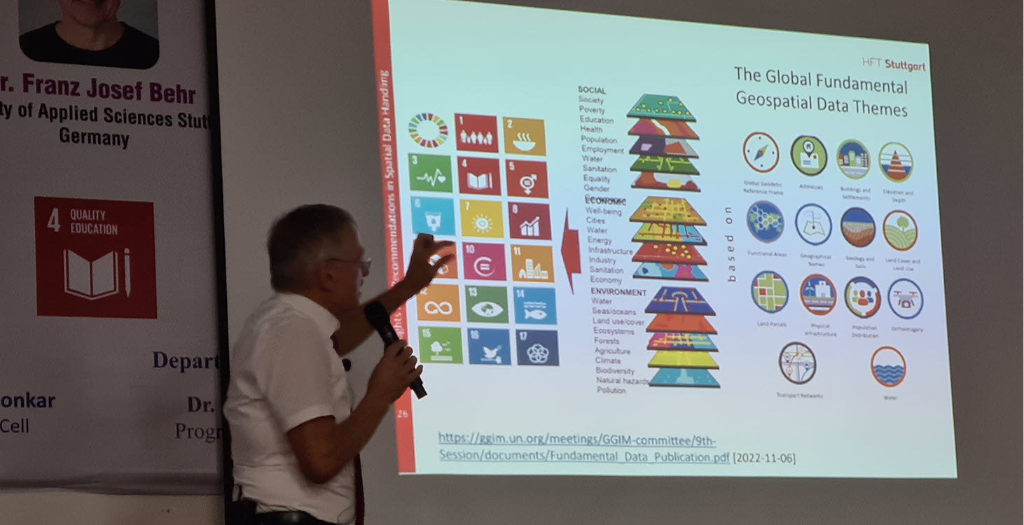
- Behr, F.-J. (2022) Some Thoughts and Recommendations in Spatial Data Handling , Holkar Science College, Indore, Madhya Pradesh, India, DOI: 10.13140/RG.2.2.14086.48960
- Behr, F.-J. & Yaha, M. (2017) Global Challenges and Data-Driven Science: An approach for raising awareness about Indicators for the Sustainable Development Goals , International CODATA 2017 Conference “Global Challenges and Data-Driven Science”, Sankt Petersburg, 2017-10-11
Disaster Management
- Behr, F.-J., Sulaeman, L., Tampupolon, W., Fleischhauer, S. (2024) Supporting OGC APIs: An Updated and Contemporary Approach to Geodata Provision in Disaster Mapping , ICCGIS 2024, Nessebar, Bulgaria
- Behr, F.-J., Fleischhauer, S. (2018) Concept and implementation of an architecture for the immediate provision of geodata in disaster management , AGSE 2018, NUST, Windhoek, Namibia
- Behr, F.-J., Fleischhauer, S. (2017) Concept and implementation of an architecture for the immediate provision of geodata in disaster management , FOSS4G EUROPE 2017, MARNE-LA-VALLÉE, 2017-07-20
- Behr, F.-J., Fleischhauer, S. (2017) Rapid just-in-time and task-adequate geodata provision for Disaster Management , AGSE 2017, Kish, Iran
SDGs and Sustainability
-
Franz-Josef Behr (2014)
Geodata for Humanitarian Affairs in UN Organisations
, ICTES 2014, University of Kelaniya, Sri Lanka
The Charter of the United Nations summarizes the aims of this international community to maintain international peace and security, to develop friendly relations among nations based on respect for the principle of equal rights and self-determination of peoples, and to achieve international co-operation in solving international problems of an economic, social, cultural, or humanitarian character, and in promoting and encouraging respect for human rights and for fundamental freedoms for all.
To achieve these goals a complex system of organizational units was created. This presentation introduces this ecosystem with focus on bodies providing or using geodata. A closer look to some units, i.e., UNEP, OCHA, UNOSAT, will be given, including their websites and the tools used.
The collaboration between involved actors is needed. Some approaches to overcome obstacles hampering interoperability will be explained, like CODs, FODs, P-Codes, and Linked Data with respect to general applicability in the geospatial field. - Behr, F.-J. & Yaha, M. (2017) Global Challenges and Data-Driven Science: An approach for raising awareness about Indicators for the Sustainable Development Goals , International CODATA 2017 Conference “Global Challenges and Data-Driven Science”, Sankt Petersburg, 2017-10-11
E-Learning
- Franz-Josef Behr, David Mathews, R. Jaishanker (2015) Assessment Of Google+ Hangout As Interactive Technology Enhanced Learning Media for Geospatial Technology , ICC 2015, Rio de Janeiro, Brazil, 23–28 August 2015
- Behr, F.-J. (2013): Open Source, OSGeo,and its contribution to eLearning , 21 Dezember 2013, AGSE 2013,CEPT University, ISPRS WG VI/2 Workshop: Innovative Learning Tools